Geographical Centre of Europe


In short
The Geographical Centre of Europe is a great place for travel enthusiasts because they can get a certificate declaring they have reached the centre of Europe.
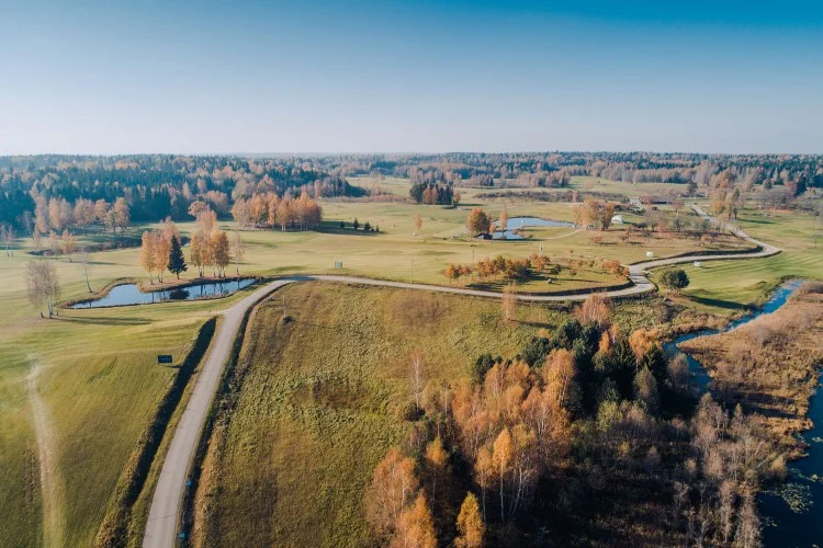
The Geographical Centre of Europe complex is located in the Village of Purnuškės, 26 kilometres from the capital. The location of the Geographical Centre of Europe was determined in 1989 by scientists from the French National Institute of Geography. The Ministry of Economy supported the tourist marking project for the geographical centre.
Brief History
On 24 May 1997, a stone marking the geographical centre of Europe was unveiled. In 2004, sculptor Gediminas Jokūbonis built a monument made of a white granite pillar with a star crown on top.
The area around the geographical centre was designated as a reserve in 1992. It includes Lake Girija, the Bernotai Mound, the hillside, the adjacent forest and other areas.
It is most convenient to get to the Geographical centre of Europe by car. From Vilnius, follow the A14 toward Molėtai until you see a sign for the Geographical Centre of Europe. You can also reach the Geographical Centre of Europe by bus from the Molėtai highway stop near the Santariškės ring (bus Vilnius-Paberžė). You should ask the driver to stop at the Geographical Centre of Europe. There is also a shuttle bus (Vilnius – Radžiuliai) going from stop 32 at the Vilnius Bus Station. Travel time is about 30 minutes and tickets can be purchased on the bus from the driver.